Showing posts with label Apple Maps. Show all posts

Tuesday, November 26, 2024

Locating USPS Collection Boxes

Today I wanted to send a physical greeting card to a friend via US mail. Our condominium complex has a dropbox for outgoing US mail, but the 4.5-inch slot was not wide enough for me to insert the greeting card without folding it. Instead of driving to the nearest post office, I decided to find the nearest United States Postal Service (USPS) collection box. The iconic blue collection box in my neighborhood was removed many years ago, and this has been happening across the US in an effort to cut costs, reduce mail theft, and possibly for other reasons.

The first thing I did was launch Apple Maps and search for “USPS Collection Box” which revealed exactly what I was looking for. Here is a representative example of what is displayed on the macOS version of Apple Maps (the iOS version looks similar):


Although Apple Maps met my needs, I wondered what the same kind of search would look like in Google Maps. To my surprise, Google Maps does not appear to include the location of USPS mailboxes, at least based on my queries for “USPS Collection Box”, “Mail Collection Box”, and other variations. My findings were consistent with this Reddit thread.

Another obvious place to look for USPS collection boxes is the USPS website, https://www.usps.com/. From the main page, simply click on Locations to invoke the search function. From there, click the “Location Type(s)” dropdown menu and select Collection Boxes as pictured here:


After entering your parameters and clicking the “Search” button, you should see a map like this:


Although the USPS collection boxes are pinned on the map, I prefer the Apple Maps version because I think it looks better and you can also navigate to the nearest collection box using the GPS function.

In summary, if you need to locate a USPS collection box and are using an Apple device, go to Apple Maps and search for “USPS Collection Box”. For all other scenarios, search for USPS collection boxes on the USPS website.

Monday, August 23, 2021

Apple Maps Guide - America’s National Parks

In recent years, Apple has celebrated the birthday of the National Park Service which was established when the Organic Act was signed into law on August 25, 1916. Last year’s Apple festivities included donations to the National Park Foundation based on selected usage of Apple Pay—details are described here.

This year marks the 105th birthday of the National Park Service, and Apple is doing something similar. Additionally, it has provided a link to an Apple Maps Guide that was created by the National Park Foundation which can be accessed here.


There are 63 locations in this guide, one for each national park. Each national park has a brief description along with a link to additional information on the National Park Foundation website.

More information about the Guides feature of Apple Maps can be found on the Apple Maps overview page, the Maps User Guide for macOS, the iPhone User Guide, or the iPad User Guide.

Monday, June 8, 2020

Aerial Photos of Black Lives Matter Plaza

On June 5, 2020, a two-block section of 16th Street NW in downtown Washington DC was renamed by Mayor Muriel Bowser to “Black Lives Matter Plaza” as part of ongoing protests against racism and police brutality aimed at black Americans. Earlier that day, the Department of Public Works painted a mural on the street with the words “Black Lives Matter” in 35-foot yellow capital letters. Today, June 8, Apple Maps not only reflects the new street name but also shows the newly painted mural from its aerial photos:


Google Maps reflects the new street name, but its photos have not yet been updated to include the mural:


There are many other mapping applications that may be updated with new images over time, so if you want to view them, enter GPS Coordinates 38.901317, -77.036539 and check for yourself.

Tuesday, April 28, 2020

Find COVID-19 Testing Locations on Apple Maps

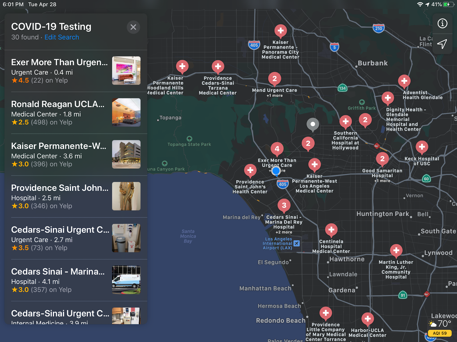
Did you know that you can now find COVID-19 testing locations on Apple Maps? This works on Apple Maps for desktop computers:


…as well as Apple Maps for iPad:


…and Apple Maps for iPhone:


Simply launch Apple Maps on any macOS or iOS device and type “COVID” in the search. Click the pre-filled “COVID-19 Testing” result and viola, you should see nearby testing sites. According to this article, COVID-19 testing sites are currently available for Apple Maps locations in the United States and Puerto Rico.

Also, Apple provides a portal that hospitals, clinics, and other providers can use to register COVID-19 testing locations. According to the FAQ, Apple will review and validate submissions before adding them to Apple Maps.