Showing posts with label Earthquake. Show all posts

Thursday, December 10, 2020

Earthquake Early Warning Apps

Having lived in California for most of my life, I’ve felt many earthquakes. Some have been larger than others, but they are all scary to me. Of all the natural disasters in the world, earthquakes are unique in that people have the least amount of time to take action when they occur. Even with the latest technology, early warning systems may give only a few seconds of advance notice before shaking is felt. I am aware of 2 apps that have this goal in mind.

The ShakeAlertLA app is provided by the Office of Los Angeles Mayor Eric Garcetti, the Information Technology Agency and the Department of Emergency Management. It has been made possible by support from the Annenberg Foundation and the Mayor’s Fund for Los Angeles. ShakeAlertLA is an official pilot in partnership with the U.S. Geological Survey. I previously wrote about it here, and more information is available at the ShakeAlert website.

The MyShake app is discussed on the Earthquake Warning California website. Earthquake Warning California is the country’s first publicly available, statewide warning system that could give California residents crucial seconds to take cover before shaking is felt. MyShake delivers ShakeAlert across California.

How does early warning work? When an earthquake happens, a rupturing fault sends out different types of waves. The first wave felt is the fast-moving P-wave. The slower-moving S-waves arrive later causing the most damage. Sensors detect the P-wave and immediately transmit data to an earthquake alert center where the location and size of the quake are determined and updated as more data become available. A message from the alert center is immediately transmitted to your computer or mobile phone with data on the expected intensity and arrival time of shaking at your location. Specifically, when your phone is stationary, MyShake is ready to collect data from its motion sensors. It then decides which motion is produced by earthquakes and which isn’t. So basically, when you install one of these apps, your phone becomes part of a seismic network for earthquake early warning, as described in this publication.

Both ShakeAlertLA and MyShake provided information about how to prepare for earthquakes and what to do during and after an earthquake. Both apps also provide maps of earthquakes, but the MyShake app shows and allows users to explore far more earthquakes, probably because it earthquakes of lower intensity. MyShake also has interactive features that allow the public (referred to as “citizen scientists”) to report their experiences. MyShake also lets users configure notifications about earthquake events—simply enter a location, radius, and intensity. Finally, MyShake has sensor that is fun to play with. It records movement along the X, Y, and Z axes and can display the information in a graph in the app (below) as well as allow users to record and export the raw data.
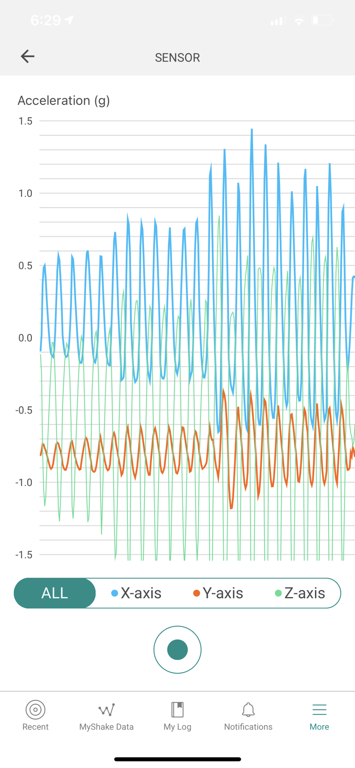
In summary, I find MyShake to have more robust features than ShakeAlertLA. Regardless of your choice, download one of them today. Even if it doesn’t save your life, you’ll be contributing to the advancement of earthquake early warning science.

Saturday, September 19, 2020

Recent LA Area Earthquakes

Last night I was rudely awakened by an earthquake. I previously wrote about the United States Geological Survey (USGS) Earthquake Hazards Program website. It presents basic seismic data (intensity and location) and is also packed with many other features (e.g., interactive map, regional information, crowdsourcing of intensity estimation of fatalities and economic losses, aftershock forecasts, and much more).

However, there is another website that is maintained by the City of Los Angeles that profiles recent LA-area earthquakes: https://earthquake.lacity.org. Perhaps the appeal of this site is its simplicity.

In my observation from social media posts, most people talk about 2 obvious pieces of data: seismic intensity and location of the epicenter. Perhaps the simplicity of the site is its main appeal.

The Recent LA Area Earthquakes does provide a slightly different view of earthquake data by presenting the strongest earthquake in the past 24 hours, the number of 1.0+ earthquakes in the past 24 hours, and a table of all 1.0+ earthquakes in the last 24 hours. However, it is done in a clear and concise manner.

Additional resources include links for getting prepared, getting notified, and the ShakeAlertLA app for iOS and Android.

Saturday, January 4, 2020

Google Crisis Map

With the recent wildfires in Los Angeles and the current fires in Australia, I’ve been tracking developments on Google Crisis Map.


On top of the usual Google Maps technology, there are additional layers of information that users can display. Categories include:
  • Public Alerts (emergency information including evacuation notices for hurricanes, storm warnings, earthquakes, etc.)
  • Tropical Storm Information (hurricanes and storms, including current location and forecast path)
  • Evacuation Resources
  • Traffic & Transit
  • Floods
  • Wildfires
While it is currently mostly focused on US-based weather and events, there is coverage of the ongoing Australian wildfires.

I wonder what the Google Crisis Map would have shown in San Bernardino County on December 26, 2019 when we got stuck on the road due to highway closures from snowstorms.

In any case, I hope you’ll never need to rely on this resource, but in the event that it may become useful in the future, now you know.

Saturday, January 12, 2019

Earthquake Alerting

About an hour ago, I felt a small earthquake and found details on the USGS website:
https://earthquake.usgs.gov/earthquakes/eventpage/ci38423128/executive


While I felt only a small jolt, I did wonder if the shaking would continue to increase in intensity or if the worst was over. Fortunately that's all I felt.

Recently I downloaded ShakeAlertLA and wondered why I did not receive an alert and if the app even registered the quake at all. Launching the app, it looks like this particular earthquake did not register in its system:


I do understand that there are many "small" earthquakes that are detected every day, so it does not make sense to alert users to every single one that is detected. However, I could not find a setting where I could set an earthquake magnitude parameter, above which I could get an alert and visualize it on the map. I suppose that would be nice, although I am also guessing that alerting capabilities might vary depending on the magnitude and other features of the earthquake.

In doing some research, this article states that ShakeAlertLA will issue alerts for all earthquakes and aftershocks in Los Angeles county of magnitude 5.0 or greater. In any case, it is also clear that the early warning system is still undergoing research and development, and I applaud the work in progress which I believe will eventually save many lives.

Monday, May 1, 2017

Earthquake!

While this technology has been available for many years, some people don't know that you can view earthquake data at the United States Geological Survey web site. For example, here's the one I felt earlier this evening:

https://earthquake.usgs.gov/earthquakes/eventpage/ci37637991#executive


In addition to details for specific earthquakes, you can view all sorts of neat things such as:

If you felt an earthquake, you can complete a Did You Feel It form in which you are prompted to answer questions such as whether or not you felt the earthquake (of course), where you were located, if you were sleeping, shake intensity, your reaction and response to the shaking, motion of objects, damage to buildings, etc.

Just in the last 30 minutes, there have been more than a thousand responses in my neighborhood:


While this data sure makes for interesting graphics, I wonder how it can be used for research and analytics and particularly if past earthquake activity can be used to predict future earthquakes.