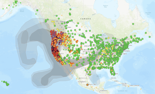
Since wildfires are burning across the western states, the air quality has been worse than usual in many parts of California, Oregon, and Washington due to the smoke.
Did you know that there is an air quality index (AQI) that quantifies the amount of pollutants in the air? It runs on a scale from 0 to 500, with higher values representing greater health hazards.
To find out AQI values in your area, visit AirNow which is a website run by the Environmental Protection Agency. There is also a mobile app for Android and iOS. Here’s an example of the current air quality in Los Angeles:
There is also a Fire and Smoke Map that overlays—you guessed it—fires and smoke information on the same map. Here’s a view of the continental United States which gives you an idea of how far-reaching the effects are of the smoke from all the wildfires:
You can drill down to see information for a particular wildfire:
And you can also click on each of the colored dots to view information that has been acquired from a specific air quality sensor.
There is a lot of other information on AirNow, including an option to receive air quality notifications.


No comments:
Post a Comment